


OS Maps: Walk, Hike, Run, Bike
3.852.00 Reviews
App Specs
- Version
- Varies with Device
- Updated On
- License
- Free
- Downloads
- 1,000,000+
- Developer
- Ordnance Survey Ltd
- Categories
- Maps & Navigation
- Platform
- Android
Screenshots

 Analysis by AppCompare
I tend to judge an outdoor map by what it helps me decide before I leave and what it still lets me do when a route gets confusing. OS Maps: Walk, Hike, Run, Bike is built around those moments: browsing terrain, shaping a route and taking that plan outside. It is a free navigation app from Ordnance Survey Ltd, the mapping specialist behind its outdoor focus, and it feels most at home when I want to explore rather than simply get from one address to another.
The app is aimed at walkers, hikers, runners and cyclists, but that range does not mean every trip needs the same planning. A familiar park loop calls for a quick route; a longer outing over unfamiliar ground deserves more thought. I like that the central idea is the map itself, with route planning and activity tools supporting it, rather than turn-by-turn driving navigation being the whole experience.
Your Adventure Awaits
When you fire up OS Maps, you're greeted with a clean and intuitive interface. It’s like a breath of fresh air compared to other clunky map apps out there. I immediately noticed the variety of activities it supports—whether you're into hiking, running, biking, or just leisurely walking, there's something for everyone.
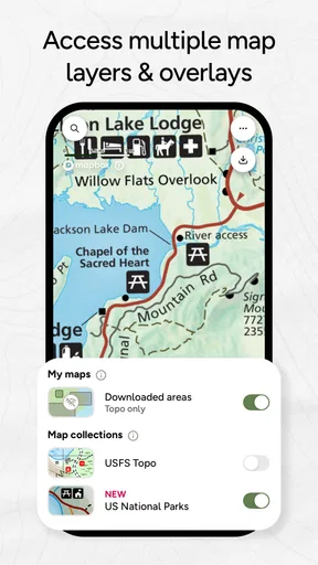
One of the coolest features is the ability to view maps in 3D. Yes, you read that right. It’s just like Google Earth, but tailor-made for outdoor enthusiasts. I spent a good amount of time just exploring trails in 3D mode, planning my next big hike. It’s perfect for visualizing those steep climbs and scenic routes before you even step foot outside.
That view is most useful as a planning aid, not a guarantee that the route will feel easy on the ground. I use terrain perspective to notice where a climb could be concentrated and to compare two possible ways across an area. It can help me arrive with a more realistic sense of the shape of a walk, but I still treat the map as one part of preparation: conditions, daylight and my own pace matter too.
Planning Your Perfect Route
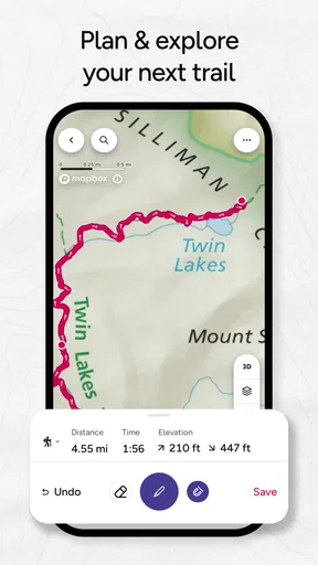
Navigating through the app, I found the route planning tools super handy. You can create your own routes or follow pre-loaded ones. I tried plotting a running route around a local park, and the app effortlessly snapped my path to existing trails, making sure I didn’t plan a detour through someone’s backyard. It’s like having a personal scout ensuring you stay on track.
That route snapping is especially useful when I sketch a loop on a small screen: I can focus on the places I want to connect instead of trying to draw every bend precisely. I still check the suggested line before relying on it. A mapped path may not suit the pace, surface or confidence level I have in mind, and a neat-looking loop is not automatically the best outing. For a run, I would prioritize a route I can follow without repeatedly stopping to inspect the phone; for a walk, I might accept extra turns if they lead through an area I want to explore.
Worth Reading Before You Choose

EA SPORTS FC Mobile 26 Is a Bigger Football Game, but It Takes Time

Flipboard Shows What News Apps Must Do Beyond the Feed

Switching to Android Auto Means Rethinking Your Driving Routine

Google Calendar Makes a Crowded Week Easier to Manage

Ludo King Makes the Most of the Minutes Between Plans

Baby Panda World Brings Quick Play to Modern Phones, but Its Game Library Feels Busy
A practical routine is to plan at home, zoom in around junctions that look ambiguous, and save the offline map before setting out. That gives me a chance to spot awkward crossings or a route that appears to double back, rather than making those decisions while tired. If I am meeting someone, I can share the route beforehand so we begin with the same plan and have a clear reference if we get separated.
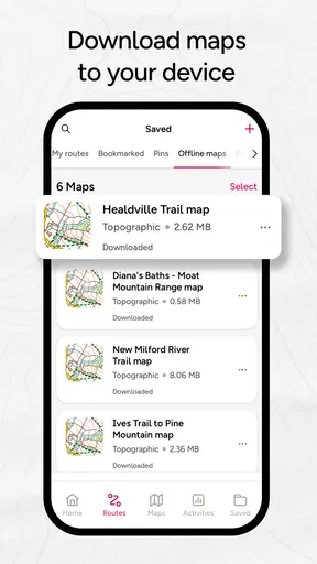
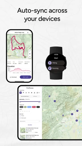
What’s even more impressive is the ability to sync maps offline. So, if you’re heading somewhere with spotty reception (hello, mountain tops!), you’re covered. I tested this feature on a recent hike, and it worked like a charm. No more worrying about losing signal at a critical fork in the road.
Offline access changes the practical value of the app on remote outings, but it works best when treated as preparation rather than a last-minute rescue. I would download the area while connected and check that the route and map are available before leaving. That small habit matters if the mobile signal fades or the battery is already under pressure. I would also keep a sensible backup plan for a serious walk; a phone map is convenient, but it does not remove the need to stay aware of surroundings and route choices.
Community and Collaboration
If you’re a social butterfly or just love sharing your adventures, OS Maps doesn’t disappoint. You can tap into a community of fellow explorers, sharing routes and tips. I stumbled upon a fantastic cycling route shared by another user, which led me to discover a picturesque trail I wouldn’t have found otherwise.
Community routes are a useful source of ideas, particularly when I want to explore beyond the paths I already know. I treat them as suggestions to review, not as a promise that another person’s outing will match my needs. Before following one, I would check its length and shape against the time I have, then inspect the map for sections that may be less suitable for my group or chosen activity. A route that works for a confident cyclist, for example, may not be the relaxed walk I am looking for.
Plus, there’s an option to share your routes with friends. So, if you find a hidden gem, you can easily let your hiking buddies in on the secret. It’s a great way to build a community around shared outdoor passions.
Sharing also has a practical side: a route sent ahead can help a group agree on a meeting point and avoid the familiar “which path did you mean?” conversation at the trailhead. I would still discuss any important choices with the people coming along rather than assuming that a shared line settles every question. The app is helpful for coordinating a plan, while decisions about timing, ability and changing conditions remain with the group.
Tracking Your Stats
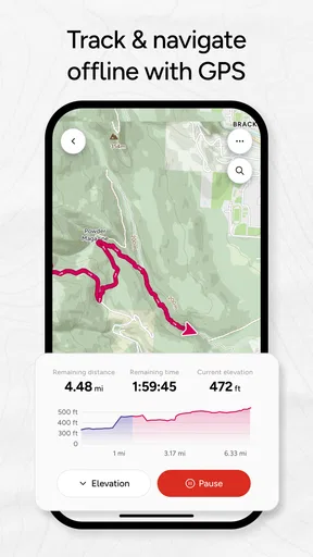
For the data geeks out there, OS Maps provides a detailed breakdown of your activities. From distance and elevation to time and pace, it’s all there. I enjoyed seeing how my usual running route stacked up against others—turns out, I’m slower than I thought! But hey, it’s all about the journey, right?
Activity records can help me notice patterns without turning every walk into a competition. If I repeat a route, I can use the record as a rough comparison with my previous outing, while remembering that stops, weather and how I felt affect the result. For a casual day outside, I would not let pace decide whether the trip was worthwhile. The more useful question is whether the route and effort suited the day I wanted.
And if you’re competitive, the app features challenges that you can participate in. It’s an excellent motivation booster to get you moving and maybe even push yourself a little harder.
Challenges add a reason to get out when I might otherwise postpone a run, though I would use them as encouragement rather than a target that overrides comfort or safety. Someone who mainly wants quiet navigation may never need this social or motivational layer, and that is fine: the map planning remains the stronger reason to consider the app.
How It Fits into an Outdoor Routine
On an ordinary weekend, I might use the app to find a new loop within reach, inspect the terrain, and decide whether it looks like a relaxed walk or a more demanding outing. Before leaving, I would save the area for offline use and share the route with the friend joining me. During the walk, the map is there for orientation; afterward, the activity record gives us a way to remember how the outing went. That simple sequence is where the different tools feel connected rather than like unrelated extras.
Compared with general-purpose map apps, OS Maps is more specifically shaped around outdoor routes and terrain planning. A standard navigation app is often the more convenient choice for finding a business, driving to a starting point or handling everyday city directions. For outdoor exploration, I value having route creation, terrain viewing and offline preparation together. The trade-off is that an activity-focused map can ask for more planning than someone wants for a short, familiar trip.
It is also worth being realistic about how much screen use an unfamiliar route can invite. If I have to keep checking the display at every bend, I have not planned well enough for an easy outing. Reviewing key turns in advance and downloading the map reduces that friction. For a group with varied confidence, I would choose a route that is easy to discuss and follow, not simply the most interesting line on the screen.
Who Will Get the Most from It
I would recommend OS Maps to people who regularly walk, hike, run or cycle somewhere beyond familiar streets and want to prepare routes rather than improvise every turn. It is especially appealing if terrain affects your choices, you like discovering routes from other users, or you often go where signal may be unreliable. The app is suitable for a broad audience, with an Everyone content rating, but the rating does not mean every mapped outing is appropriate for every person; route choice still needs to match the group and conditions.
Someone who only needs simple point-to-point directions may find a standard maps app quicker. Likewise, if you do not plan routes, explore trails or care about recording outdoor activity, many of OS Maps’ distinctive tools may go unused. I would not choose it solely for social features or statistics; the clearest reason to install it is a genuine interest in outdoor mapping.
The app is free to start, with in-app purchases ranging from $0.99 to $35.99 per item. I would explore the basic experience and decide whether its route and map tools fit my habits before spending anything. That range makes it sensible to check what a purchase is for in the app rather than assuming every outdoor map or planning function is included at no cost.
Current State and What to Watch
OS Maps has been available since June 16, 2015, and has grown to more than a million installs. Its average rating is 3.8 from around 35,000 ratings, with 51 written reviews. Those figures suggest a well-established app with a substantial audience, but they are not a substitute for deciding whether its approach suits your own trips. I would focus on whether you value detailed outdoor planning enough to use it regularly.
The verified release information establishes when the app first appeared, but does not provide a version-by-version history to compare. I therefore would not claim a particular recent redesign or feature change. For existing users, the practical test is whether the current route, offline and activity tools continue to fit the way they go outside; for a new user, the best next step is to try planning a modest route and see whether the workflow feels natural.
When considering any future changes, I would watch for improvements that make route planning clearer, offline preparation easier to verify, and shared routes more useful to assess before starting. Those are areas that affect real decisions in the field. I would also look for clear explanations of paid options, since knowing what a purchase adds helps people judge whether it is relevant to their own use.
Wrapping It Up
To sum it all up, OS Maps: Walk, Hike, Run, Bike is a fantastic app for anyone looking to explore the great outdoors. Its user-friendly interface, robust feature set, and community integration make it a standout choice for adventurers of all levels. Whether you’re a weekend warrior or a seasoned trailblazer, there’s something in it for you.
My enthusiasm comes with a condition: the app is at its best when I make time to plan, save the map and choose a route that fits the people going with me. It is less compelling as a replacement for everyday street directions, and no map can make a poor route choice sensible. For outdoor-minded users, though, having planning, terrain, offline access and activity tracking in one place is a persuasive combination.
So, if you’re ready to embark on your next adventure, grab this app, lace up those hiking boots, and hit the trails. Who knows what amazing places you’ll discover?
Pros
- Comprehensive offline maps available.
- Accurate route tracking features.
- User-friendly interface design.
- Extensive range of hiking trails.
- Regular updates with new features.
Cons
- Limited free features available.
- Requires registration for full access.
- Occasional GPS inaccuracies.
- High battery consumption during use.
- Subscription cost for premium features.
FAQs for OS Maps: Walk, Hike, Run, Bike
What features does OS Maps offer for outdoor activities?
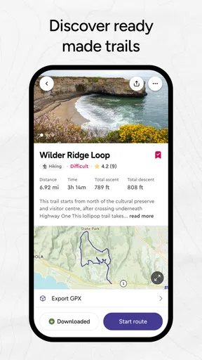
OS Maps provides a comprehensive suite of features for outdoor enthusiasts, including detailed topographic maps, route planning, and GPS tracking. Users can access offline maps, create custom routes, and explore pre-made trails. The app also offers 3D mapping to visualize terrains, making it a versatile tool for walkers, hikers, runners, and cyclists.
Is OS Maps available offline, and how does it work without an internet connection?
Yes, OS Maps allows users to download maps for offline use. This is particularly beneficial when exploring remote areas with limited internet access. Users can pre-load maps of their chosen area, ensuring they have access to essential navigation tools and routes even without a data connection, thus enhancing safety and convenience.
How does OS Maps compare to other navigation apps for outdoor activities?
OS Maps stands out for its high-quality, detailed topographic maps, which are crucial for precise navigation in outdoor settings. Unlike some competitors, OS Maps offers official Ordnance Survey maps for the UK, known for their accuracy. Its user-friendly interface and robust features make it a preferred choice among serious outdoor enthusiasts.
What are the subscription options for OS Maps, and what do they include?
OS Maps offers both free and premium subscription options. The free version provides basic access to maps and route planning, while the premium subscription unlocks advanced features such as offline maps, augmented reality, and access to premium trails. Subscriptions can be monthly or annual, catering to different user needs and preferences.
Can OS Maps be used for multiple types of outdoor activities?
Absolutely, OS Maps is designed to cater to a variety of outdoor activities, including walking, hiking, running, and cycling. Its versatile tools and features, such as route planning and GPS tracking, are adaptable to different terrains and activity types, making it a one-stop solution for outdoor adventure planning.


